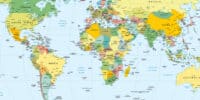
The UN voted to change the traditional world map to a new one called the Equal Earth map. This new map shows the real size of Africa and countries near the equator .
The old Mercator map was made for ocean travel, so it makes places near the poles, like Greenland, look much bigger than they really are. Most countries supported the non-binding resolution , but the United States voted against it. They called the idea political.
Experts say that no flat map is perfect, but the new map helps people see the true size of continents. This change will help schools and governments understand world issues much better.